
[hr]
Course Details
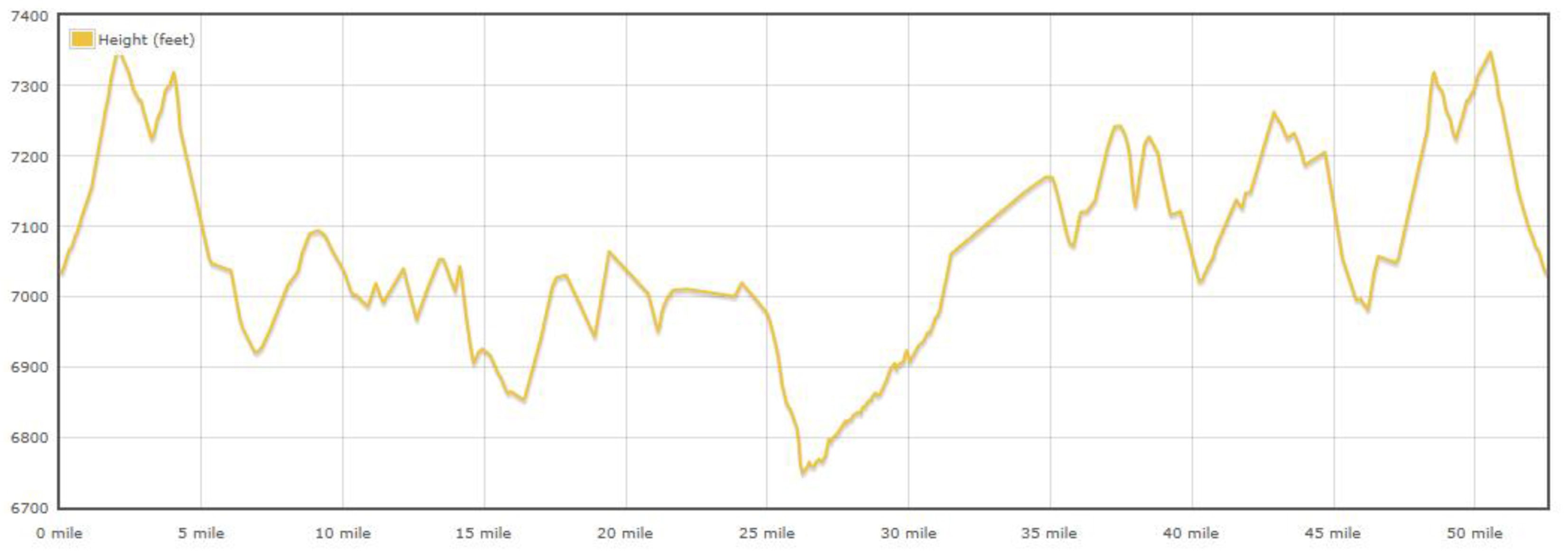
Distance: 52.5 miles
Elevation Gain: 2,500 Feet
Estimated Time: 3-6 hours
Click for Bikeroutetoaster.com for download
Bikeroutetoaster.com instructions:
- Click “Settings” on the top tool bar to change from Metric to Imperial measure.
- To download, click “Export” and choose from TCX, GPX, KML, CSV, XML, and Garmin
Click for Turn-by-Turn Directions
Elevation Graph:
Questions? Do you have any questions? Are you wondering about tires or what the terrain is like? Ask it on the Forum
Riders will also be provided with course cues on ride day. There are NO course markings. You should be prepared and know the course.