
Ride Report: Riding Gravel in the Carrizo Plains – by Grannygear
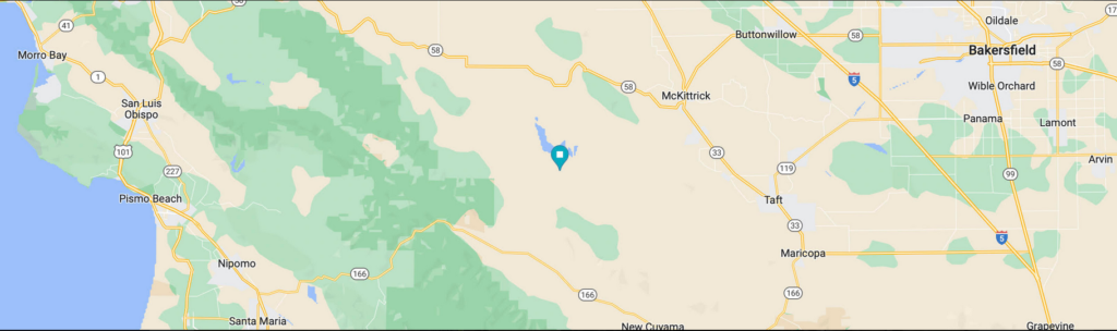
Located roughly between the farmlands of Bakersfield and the Central Coast of California is an area that I had heard of but never been to. It is not a place one would just drive by on the way to somewhere because it is pretty much in the middle of the proverbial nowhere.
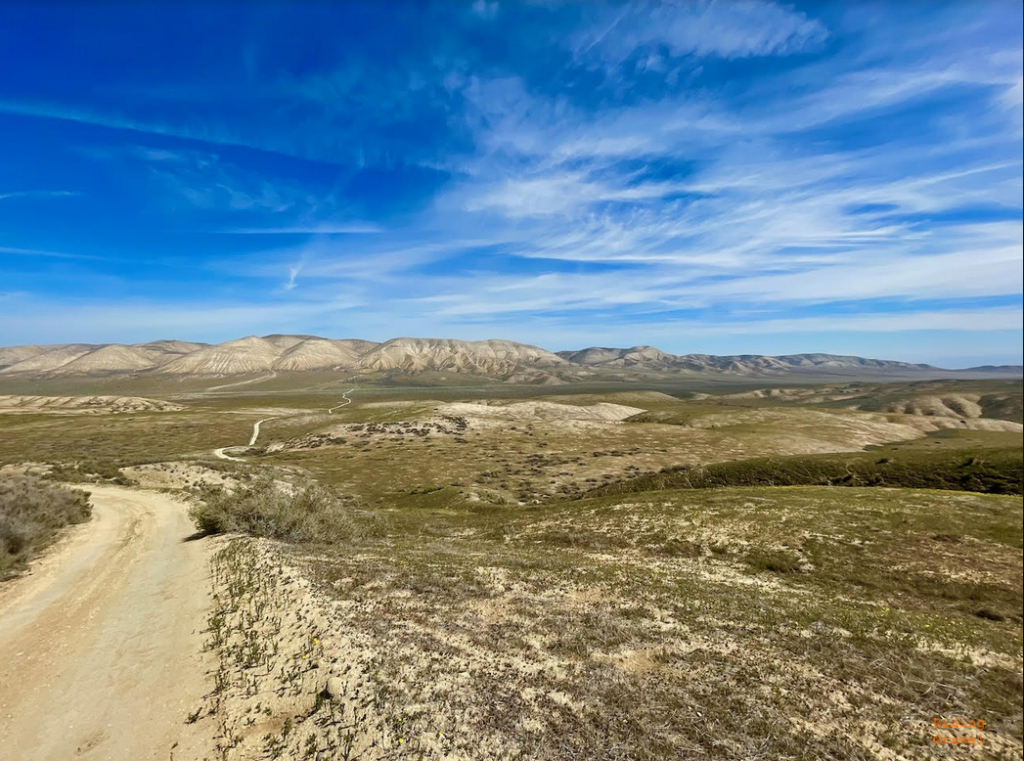
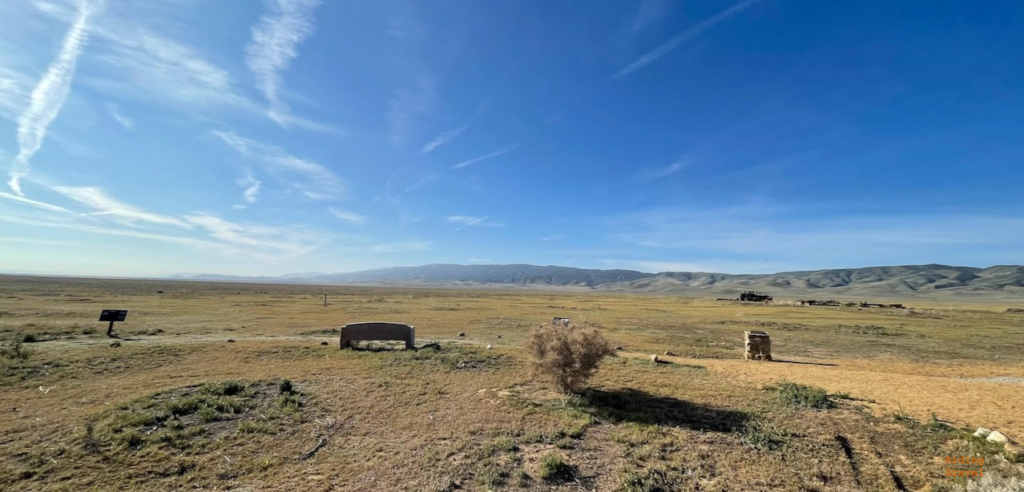
And that nowhere feeling continues when one is in the middle of what is called the largest remaining section of native grasslands in California.
The Carrizo Plains National Monument. https://www.blm.gov/programs/national-conservation-lands/california/carrizo-plain-national-monument, established on January 17th, 2001, is 204,107 acres of public land, managed by the Bureau of Land Management.
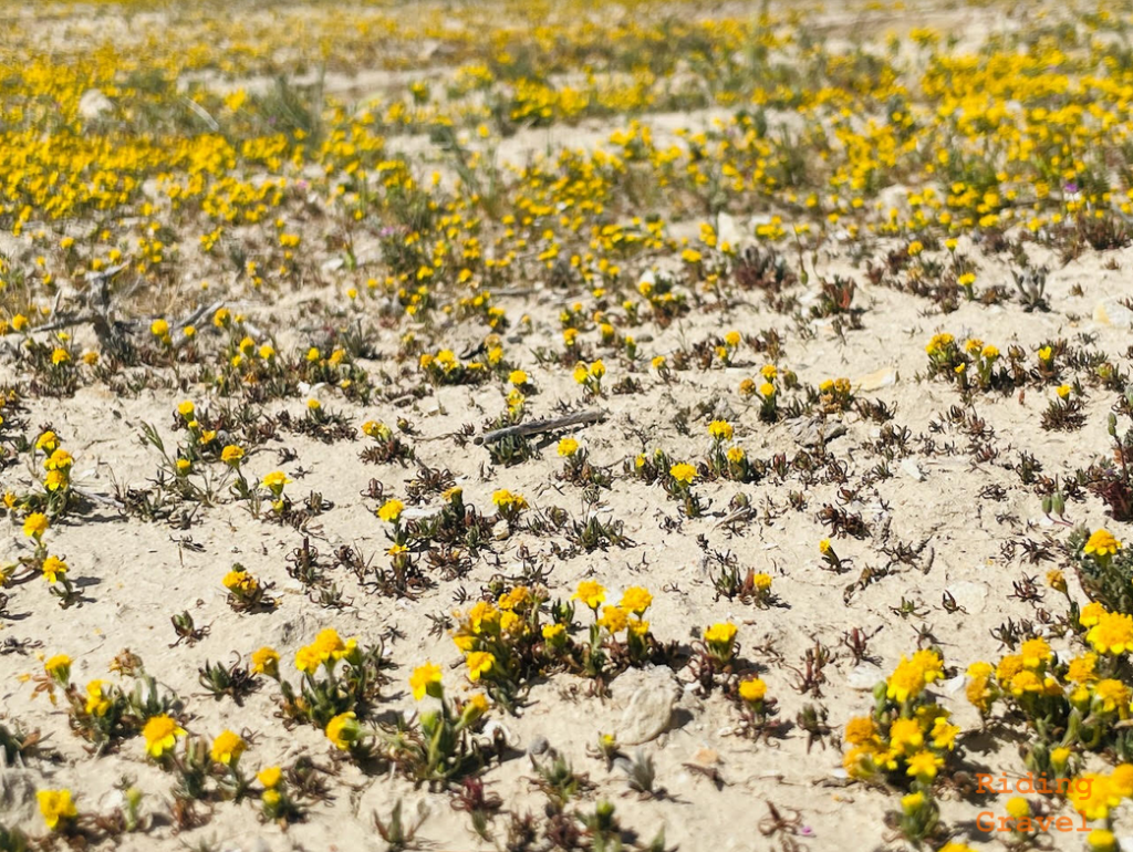
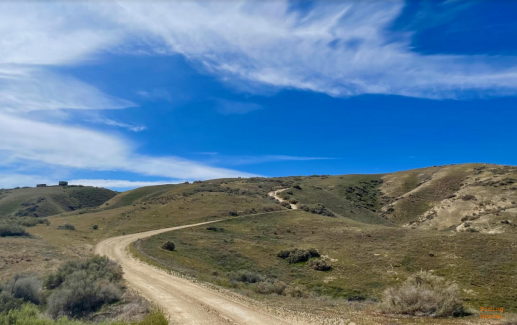
It is criss-crossed with dirt roads that roll through open plains covered in low grasses and not much else. In the right seasons, wildflowers can carpet things pretty nicely, but that depends on rainfall, etc.
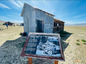
There are abandoned farm buildings, a couple of rough campgrounds, a large dry lake bed (Soda Lake) and lots and lots of open space.
Hot in the summer (with little if any shade), the Carrizo Plains are best traveled in the shoulder seasons. Heavy rains could impact roads with a high clay content, making for muddy messes of everything. But spring is the best bet, with a possibility of green grass and wildflowers. There are elk here and, I am told, antelope, of all things!
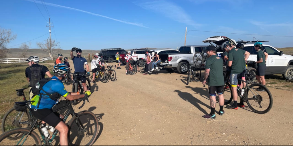
We rode here with a group out of Visalia Cyclery , and the ride was put on by Ride California https://ridecaventures.wixsite.com/ridecalifornia and so we had not only a route to go by, but also SAG support. Our route covered 60 miles of some of the most open, remote feeling roads I have pedaled over. It reminded me of Death Valley in that way, but with a very different character. If I would have been dropped in there blindfolded and then let loose, I might have said “Midwest, somewhere”.
The roads we were on were a mix of pavement, washboarded sandy dirt roads, and smoother more clay soil areas. The worst part was the washboard and we spent a good deal of time searching for that elusive smooth line. Still, the sand was not too bad and overall the road surfaces were very doable by gravel bike.
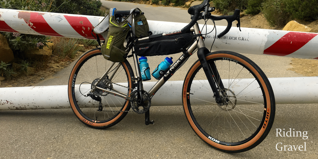
I was on the Lynskey GR250 running the WTB Vupine 36s and they were big enough for the day and fast as always. I would not go any smaller in tire size. An XC MTB would also be good here too.
It is not an area of great elevation changes, but the 60 miles we rode took its toll on us, mostly due to the slower road surfaces and the heat of the day, mid eighties even in March. This could be a very unforgiving area and there is no water, little shade, no cell service I saw, and few other visitors in some of the more remote offshoots from the main drag.
We began and ended at the Visitor Center where there was a restroom, etc.
The campgrounds here are small and few in number, but this is BLM land so dispersed camping is allowed as long as you are off the main roads (as you would be anyway). Bring everything with you. The roads here in dry conditions are what I would call ‘Subaru friendly’. Most any SUV would be fine, especially AWD ones for the more unrefined roads here that I saw, but the main roads are good for pretty much anything you could drive down a bumpy dirt road. Note that entering from the north end of the Monument does allow for very little dirt road driving as you head to the Visitor Center and Soda Lake, but coming in from the South end does not.
Here is the Strava file from my day here. My time was slow over the first 35 miles with group stops and noodling around, but the last 25 miles was more of a hard push. https://www.strava.com/activities/6888604604
Although we did a fairly hard loop here, if one rode out of a camp area or from the visitor center, the ride could be tailored to fit a lesser effort. It also would be an interesting area for bike packing or Overlanding.
The Carrizo Plains are a unique area to visit and ride in and should be on a gravel rider’s list of places to see in the Central Cal area.
Cool ride report! Thanks for sharing such an inter Singh and unknown place!